
Phaistos (Greek: Φαιστός), also transliterated as Phaestos, Festos and Latin Phaestus, currently refers to a Bronze Age archaeological site at Faistos, a municipality in south central Crete.
Ancient Phaistos was located about 5.6 km (3.5 mi) east of the Mediterranean Sea.
The name, Phaistos, survives from ancient Greek references to a city in Crete of that name, shown to be, in fact, at or near the current ruins.
The name is substantiated by the coins of the classical city.
They display motifs such as Europa sitting on a bull, Talos with wings, Heracles without beard and being crowned, or Zeus in a form of a naked youth sitting on a tree.
On either the obverse or the reverse the name of the city, or its abbreviation, is inscribed, such as ΦΑΙΣ or ΦΑΙΣΤΙ, for Phaistos or Phaistios (adjective, “of Phaistos”) written either right-to-left or left-to-right.
These few dozen coins were acquired by collectors from uncontrolled contexts.
They give no information on the location of Phaistos. Phaistos was located by Thomas Abel Brimage Spratt, commander of the Spitfire, a paddle steamer, in the Mediterranean Survey of 1853, which surveyed the topography, settlements and monuments of Crete.
Spratt followed the directions of Strabo, who said: “Of the three cities that were united under one metropolis by Minos, the third, which was Phaestus, was razed to the ground by the Gortynians; it is sixty stadia distant from Gortyn, twenty from the sea, and forty from the seaport Matalum; and the country is held by those who razed it.”
The simple geometric problem posed by these distances from known points was solved with no difficulty by the survey.
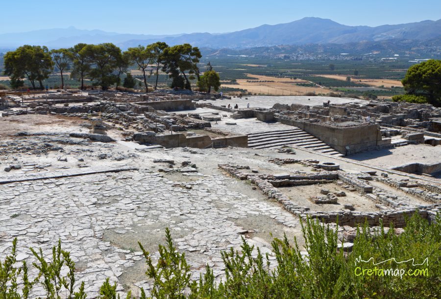
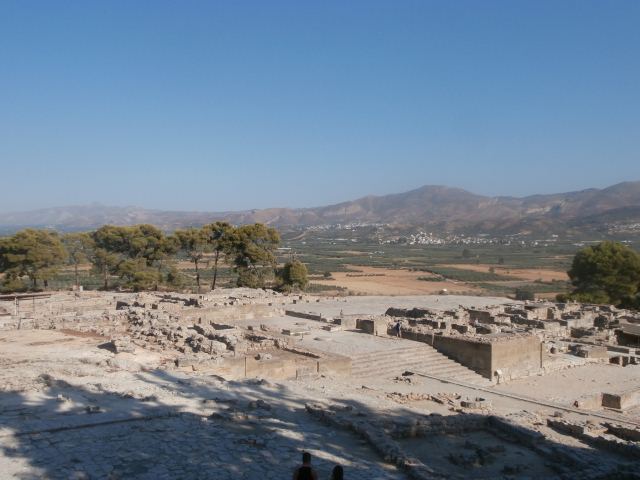
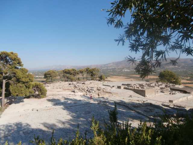
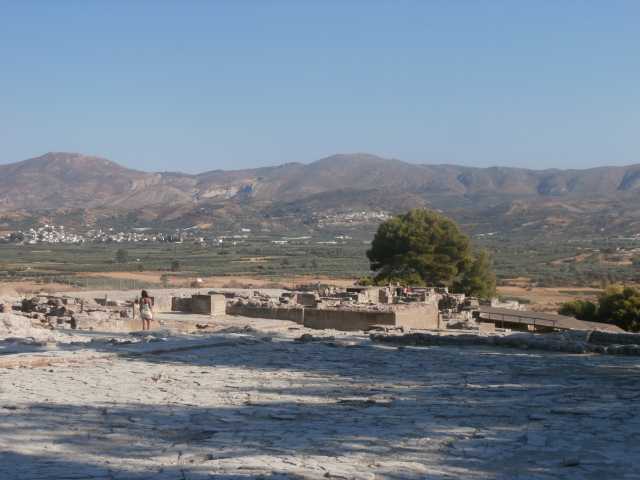
The location pinpointed was the eastern end of a hill, or ridge, rising from the middle of the Yeropotamos river valley extending from the sea to the Mesara Plain in an east-west direction.
The hill was called kastri (“fort”). A military man, Spratt understood the significance of the location immediately: “I thus found that Phaestus had occupied the extremity of a ridge that divides the maritime plain of Debaki from the plain of the Messara, so as to command the narrow valley of communication….” A village of 16 houses remained on the ridge, but the vestiges of fortification walls indicated a city had once existed there.
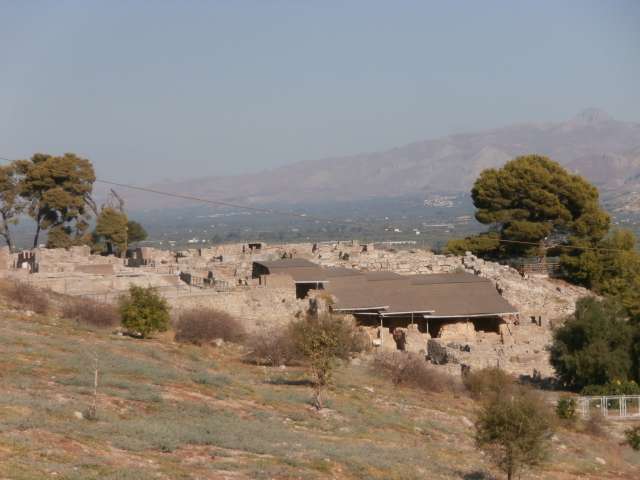
A half-century later, on removing the houses, Federico Halbherr and his crew begn to discover the remains of an extensive palace complex.
As he had begun excavation before Evans at Knossos in 1900, he did not have the advantage of Evans’ concepts of Minoan civilization.
Excavation ended in 1904, to begin again after another half-century, in 1950.
By this time it was understood that the palace had been constructed at the beginning of the Proto-Palace Period, along with all the others.
After 1955 the place name, pa-i-to, interpreted as Phaistos, began to turn up in the Linear B tablets at Knossos, then under the Mycenaean Greeks. There was every reason to think that pa-i-to was located at Kastri.
No Linear B has been found at Phaistos, and yet tradition and the Knossos tablets suggest that Phaistos was a dependency of Knossos.
Moreover, only a few pieces of Linear A have been found.
As Phaistos appears to have been an administrative center, the lack of records is paradoxical. However, the lack of an expected event is not an argument for any conclusion.
There are many possible reasons for the deficit.
Records may yet be found. In 1908, Pernier found the Phaistos disc at the basements of the northern group of the palace.
This artifact is a clay disk, dated to between 1950 BC and 1400 BC and impressed with a unique sophisticated hieroglyphic script.
The tombs of the rulers of Phaistos were found in the cemetery that was discovered 20 minutes away from the palace remains.
Bronze Age
Phaistos was inhabited from about 4000 BC. A palace, dating from the Middle Bronze Age, was destroyed by an earthquake during the Late Bronze Age. Knossos along with other Minoan sites was destroyed at that time.
The palace was rebuilt toward the end of the Late Bronze Age.
The first palace was built about 2000 BC.
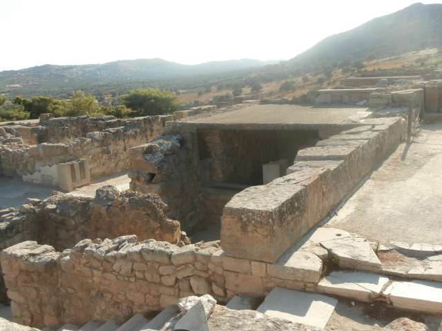
This section is on a lower level than the west courtyard and has a nice facade with a plastic outer shape, a cobbled courtyard, and a tower ledge with a ramp, which leads up to a higher level.
The old palace was destroyed three times in a time period of about three centuries. After the first and second disaster, reconstruction and repairs were made, so there are distinguished three construction phases. Around 1400 BC, the invading Achaeans destroyed Phaistos, as well Knossos. The palace appears to have been unused thereafter, as evidence of the Mycenaean era have not been found.
The Old Palace was built in the Protopalatial Period, then rebuilt twice due to extensive earthquake damage.
When the palace was destroyed by earthquakes, the re-builders constructed a New Palace atop the old. Several artifacts with Linear A inscriptions were excavated at this site.
The name of the site also appears in partially deciphered Linear A texts, and is probably similar to Mycenaean ‘PA-I-TO’ as written in Linear B. Several kouloura structures (subsurface pits) have been found at Phaistos.
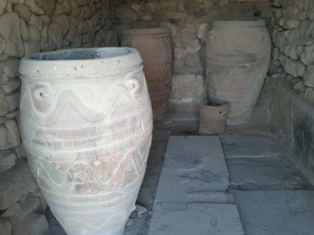
Pottery has been recovered at Phaistos from in the Middle and Late Minoan periods, including polychrome items and embossing in imitation of metal work.
Bronze Age works from Phaistos include bridge spouted bowls, eggshell cups, tall jars and large pithoi. In one of the three hills of the area, remains of the middle neolithic age have been found, and a part of the palace which built during the Early Minoan period.
Another two palaces seems to have been built at the Middle and Late Minoan Age.
The older looks like the minoan palace of Knossos, although this is smaller. On its ruins (probably destroyed by an earthquake around 1600 BC) a palace of the later minoan period was built, bigger and magnificent.
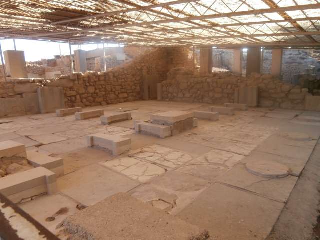
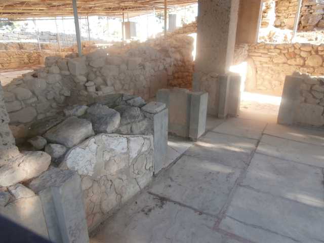
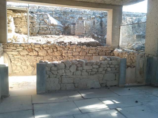
This mansion consists from several rooms separated by columns.
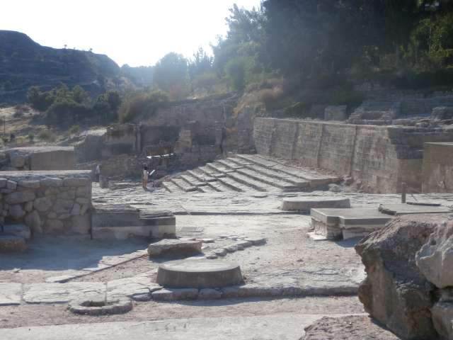
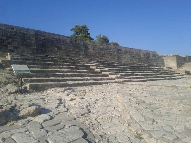
The levels of the theater area, in conjunction with two splendid staircases, gave a grand access to the main hall of the Propylaea with the high doors.
A twin gate led directly to the central courtyard through a street with a large width.
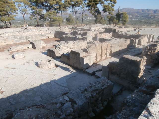
The splendour of the rooms interior owed to the investment of the floors and walls with plates of sand and white gypsum stone.
To the upper floors of the west sector existed spacious ceremonies rooms, although their exact restoration was not possible.
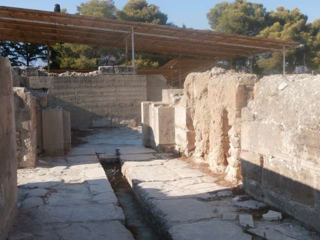
A brilliant entrance from the central courtyard was leading to the royal apartments in the north part of the palace, which they had view to the tops of Psiloritis, while for their construction had been used alabaster among other materials.
For the princes particular rooms were used, smaller and less luxurious than the rooms of the royal departments.
Iron Age
The reference of Phaistos to the ancient Greek literature is quite frequent.
Phaistos is first referenced by Homer as “well populated”, and the Homeric epics indicate its participation in the Trojan war.
The historian Diodorus Siculus indicates that Phaistos, together with Knossos and Kydonia, are the three towns that were founded by the king Minos on Crete.
Instead, Pausanias and Stephanus of Byzantium supported in their texts that the founder of the city was Phaestos, son of Hercules or Ropalus. Especially the city of Phaistos is associated with the mythical king of Crete Rhadamanthys.
The new inhabitance began during the Geometric Age and continued to historical times (8th century BC onwards), up to the 3rd century, when the city was finally destroyed by neighboring Gortyn.
Phaistos had its own currency and had created an alliance with other autonomous Cretan cities, and with the king of Pergamon Eumenes II. Around the end of the 3rd century BC, Phaestos was destroyed by the Gortynians and since then ceased to exist in the history of Crete.
Scotia Aphrodite and goddess Leto (was called and Phytia also) worshiped there.
People of Phaistos were distinguished for their funny adages. Phaistian in his descent was Epimenides who was the wise man who had been invited by the Athenians to clean the city from the Cylonian affair (Cyloneio agos) at the 6th cent. BC
source: en.wikipedia.org

